3,021 ft
Distance
40 ft
Climb
-416 ft
Descent
00:01:56
Avg time
Banshee Details
-
Riding AreaBailey Mountain Bike Park
Mars Hill, North Carolina -
Difficulty Rating
-
Trail TypeMachine Groomed
-
Bike TypeDH, AM
-
Trail UsageBiking Primary
-
DirectionDownhill Primary
-
Physical RatingModerate
-
Dogs AllowedYes
-
TTFs on TrailBerm, Jump, Roller Coaster
-
Global Ranking#31205 in Mountain Biking
-
Local Popularity65 in Mountain Biking
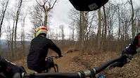
Jump line that follows the shuttle road down to Little Red Riding Hood. Consists of lots of table tops, fast roller coaster sections, and a few small gaps with optional trails off to the side.
Bike Park
More Stats for Banshee bike trail
-
Altitude change-376 ft
-
Altitude min2,899 ft
-
Altitude max3,275 ft
-
Altitude start3,275 ft
-
Altitude end2,899 ft
-
Grade-12.447%
-
Grade max-39.261%
-
Grade min20.973%
-
Distance climb249 ft
-
Distance down2,526 ft
-
Distance flat245 ft
-
Avg time00:01:56
-
Avg reverse time00:01:58
- view trail stats
close
Trail Conditions
- Unknown
- Snow Groomed
- Snow Packed
- Snow Covered
- Freeze/thaw Cycle
- Icy
- Prevalent Mud
- Wet
- Variable
- Dry
- Very Dry
Trail Ridden Direction
Trailforks scans users ridelogs to determine the most popular direction each trail is ridden. A good flowing trail network will have most trails flowing in a single direction according to their intension.
The colour categories are based on what percentage of riders are riding a trail in its intended direction.
The colour categories are based on what percentage of riders are riding a trail in its intended direction.
- > 96%
- > 90%
- > 80%
- > 70%
- > 50%
- < 50%
Trail Last Ridden
Trailforks scans ridelogs to determine the last time a trail was ridden.
- < 2 days
- < 1 week
- < 2 weeks
- < 1 month
- < 6 months
- > 6 months
Trail Ridden Direction
The intendid direction a trail should be ridden.
- Downhill Only
- Downhill Primary
- Both Directions
- Uphill Primary
- Uphill Only
- One Direction
ContributeDetails
Colors indicate trail is missing specified detail.
- Description
- Photos
- Description & Photos
- Videos
LEGEND
Trail Difficulties
Trail Report Status
- Access Road/Trail
- White
- Green
- Blue
- Black
- Double Black Diamond
Trail Report Status
- Clear / Green
- Minor Issue / Yellow
- Significant Issue / Amber
- Closed or Major Issue / Red
- Land Owner Overlay
- Wilderness (typically no bikes in USA)
- BLM (public)
- USFS (Wildlife sanctuaries darker than usfs)
- State land
- Indigenous
- Military
Trail Conditions
- Unknown
- Snow Groomed
- Snow Packed
- Snow Covered
- Freeze/thaw Cycle
- Icy
- Prevalent Mud
- Wet
- Variable
- Dry
- Very Dry
- Map Markers
 Trail Head
 Photo
Photo Directory Listing
 Riding Area
 TTF
TTF Parking
 Viewpoint
 Information
 Warning
 Directions
 Water Fountain/Source
 Sight
Sight Restrooms
 Gate
Gate Camping
 Trail Sign
 Table or Bench
 eBike Charging Point
 Other
Other
Directions to banshee-63170 trailhead
(35.849035, -82.579712)
update trails status or condition
Banshee Trail Reports
view all reports »
Recent Ridelog Activity on Trail
Past Week
- 0 rides
6 Months
- 24 rides
- 21 miles avg distance
All
- 514 rides
Photos
more »
Reviews / Comments
No reviews yet, be the first to write a review or ask a question.
Use trail reports to comment on trail conditions.
Videos
more »

4:52 |
87 |
Sep 19, 2018 , Mars Hill

2:24 |
253 |
Apr 3, 2017 , Mars Hill
3:55 |
160 |
Feb 26, 2017 , Mars Hill

0:25 |
737 |
Feb 19, 2017 , Mars Hill
Nearby Trails
- dr. jekyll 0 ft
- mr. hyde 79 ft
- blue dh 105 ft
- utgard 594 ft
- rick james 643 ft
Bailey Mountain Bike Park
- embed Banshee trail on your website
- By davehuffstetler BMBP & contributors
- #63170 - 1,263 views
- subscribe
- login to download gpx or kml files.
Open trail in mobile app