7 miles
Distance
910 ft
Climb
-941 ft
Descent
01:16:54
Avg time
Mt. Zion Bike Trail Details
-
Riding AreaMt. Zion
Brookhaven, Mississippi -
AKARC Trail
-
Difficulty Rating
-
Trail TypeSingletrack
-
Bike TypeAM, XC
-
Trail UsageBiking Primary
-
DirectionBoth Directions
-
Climb DifficultyBlue
-
Physical RatingModerate
-
SeasonAll year
-
Dogs AllowedYes
-
TTFs on TrailBerm, Bridge, Jump, Gap Jump, Teeter Totter, Wallride
-
Global Ranking#5497 in Mountain Biking
-
Local Popularity100 in Mountain Biking [+]
- 5 in Trail Running
- 5 in Hiking
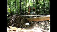
"The Biggest Little Trail in Mississippi " is about 9 miles of flowing singletrack excitement. There are climbs that reward you with speedy downhill fun, sections of tight and technical terrain, flowing areas that leave you with a grin. You will find over 45 wooden features, bridges , ramps, berms, walls, a 14' see-saw, tabletops and more. All jumps offer by-passes. You can choose the 9 mile loop, 6 mile loop, a 2 mile beginner loop, or a 1 mile kids loop. A pavilion has a fridge with free Popsicles A bike wash and port-potty are on site. Text for trail conditions 601-754-7785. A free trail ride that 1000% of donations go to the trail...and always the greatest hospitality in the world !!! Come and enjoy
Local Trail Association
- Please consider joining or donating to the local riding association to support trail development & maintenance.donate to earn trail karma!
More Stats for Mt. Zion Bike Trail bike trail
-
Altitude change-30 ft
-
Altitude min444 ft
-
Altitude max517 ft
-
Altitude start502 ft
-
Altitude end472 ft
-
Grade-0.085%
-
Grade max-41.708%
-
Grade min22.412%
-
Distance climb3 miles
-
Distance down3 miles
-
Distance flat1 miles
-
Avg time01:16:54
-
Avg reverse time00:23:12
- view trail stats
close
Trail Conditions
- Unknown
- Snow Groomed
- Snow Packed
- Snow Covered
- Freeze/thaw Cycle
- Icy
- Prevalent Mud
- Wet
- Variable
- Dry
- Very Dry
Trail Ridden Direction
Trailforks scans users ridelogs to determine the most popular direction each trail is ridden. A good flowing trail network will have most trails flowing in a single direction according to their intension.
The colour categories are based on what percentage of riders are riding a trail in its intended direction.
The colour categories are based on what percentage of riders are riding a trail in its intended direction.
- > 96%
- > 90%
- > 80%
- > 70%
- > 50%
- < 50%
Trail Last Ridden
Trailforks scans ridelogs to determine the last time a trail was ridden.
- < 2 days
- < 1 week
- < 2 weeks
- < 1 month
- < 6 months
- > 6 months
Trail Ridden Direction
The intendid direction a trail should be ridden.
- Downhill Only
- Downhill Primary
- Both Directions
- Uphill Primary
- Uphill Only
- One Direction
ContributeDetails
Colors indicate trail is missing specified detail.
- Description
- Photos
- Description & Photos
- Videos
LEGEND
Trail Difficulties
Trail Report Status
- Access Road/Trail
- White
- Green
- Blue
- Black
- Double Black Diamond
Trail Report Status
- Clear / Green
- Minor Issue / Yellow
- Significant Issue / Amber
- Closed or Major Issue / Red
- Land Owner Overlay
- Wilderness (typically no bikes in USA)
- BLM (public)
- USFS (Wildlife sanctuaries darker than usfs)
- State land
- Indigenous
- Military
Trail Conditions
- Unknown
- Snow Groomed
- Snow Packed
- Snow Covered
- Freeze/thaw Cycle
- Icy
- Prevalent Mud
- Wet
- Variable
- Dry
- Very Dry
- Map Markers
 Trail Head
 Photo
Photo Directory Listing
 Riding Area
 TTF
TTF Parking
 Viewpoint
 Information
 Warning
 Directions
 Water Fountain/Source
 Sight
Sight Restrooms
 Gate
Gate Camping
 Trail Sign
 Table or Bench
 eBike Charging Point
 Other
Other
Directions to mt-zion-bike-trail trailhead
(31.656260, -90.498790)
update trails status or condition
Mt. Zion Bike Trail Trail Reports
view all reports »
Recent Ridelog Activity on Trail
Past Week
- 1 rides
- 17 miles avg distance
6 Months
- 15 rides
- 13 miles avg distance
All
- 56 rides
Photos
more »
-
+ 0
Awesome trail ...well maintained and marked. The entire trail is actually 9.98 miles ... flowy fun, awesome trailhead ..
[Reply]
Videos
more »

14:59 |
50 |
Sep 22, 2018 , Brookhaven
3:30 |
695 |
Nov 17, 2011 , Brookhaven
Nearby Trails
- b loop 1,112 ft
- rc connect 1,165 ft
- kids loop 1,234 ft
- embed Mt. Zion Bike Trail trail on your website
- By markholloway Trailforks Plus & contributors
- #47566 - 1,520 views
- subscribe
- login to download gpx or kml files.
Open trail in mobile app